
Route Summary
 A great coastal walk taking in old fishing villages and historic buildings alongside the natural beauty of a wide sandy bay and striking rock formations. The route alternates between sea and cliff-top level with a final section in landscaped woodland and farmland.
Duration: 3 hours.
Route Overview
Duration: 3 hours.
 Transport/Parking: Stagecoach buses from Aberdeen and Elgin pass through Cullen. Check timetables. Free public car-park at start/finish of walk.
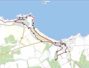
Length: 9.670 km / 6.04 mi
Height Gain: 202 meter Height Loss: 202 meter
Max Height: 54 meter Min Height: 3 meter
Surface: Moderate. Good paths and paved surfaces. Take care on cliff paths! Not suitable for offroad mobility scooters due to very uneven rocky surface at Waypoint 4. As an alternative, it is possible to reach Portknockie, from Cullen, on the old railway line path (access from North Deskford Street).
Child Friendly: Yes, if children are used to walks of this distance and overall ascent. Take care on cliff-side paths!
Difficulty: Medium.
Dog Friendly: Yes, on lead on public roads and near farm animals.
Refreshments: Options in Cullen.
Description
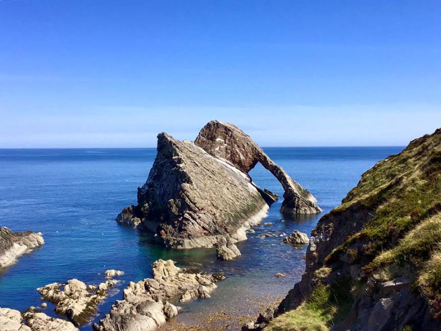
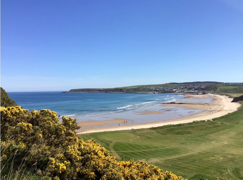
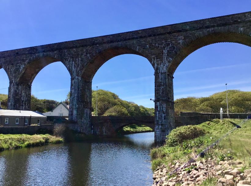 This is an excellent walk on the scenic Banffshire coast, an area now part of Moray, which enjoys a benign micro-climate, sheltered by the Grampian Mountains. The route offers variety and historical interest, alongside stunning views. Cullen is an attractive large village. It has a long history, having been made a royal burgh around the end of the 12th C. The old village, which ran downhill from Cullen House is long gone. Nowadays, there is a clear distinction between picturesque and colourful Seatown of Cullen, the fishing quarter, nestled into the broad bay, and the grander “New Cullen” rising uphill and inland. These were planned settlements, built in the 1820’s, as was the fine harbour, built by Thomas Telford to take advantage of the opportunities for trade and the booming herring industry. The impressive railway viaducts featuring on the walk served the original Great North of Scotland coastal line from Aberdeen to Elgin. They were saved from demolition after the Beeching cuts of 1964. After skirting the marvellous sweep of Cullen Bay, the route passes Jenny’s Well, named after a poor woman in times past who lived in a cave nearby. The well figured in local folk-customs, associated with May Day. After climbing to the Portknockie headland we come upon the focal point on the route – the hugely impressive and photogenic Bow Fiddle Rock – a natural sea arch, so called because it resembles the tip of a fiddle bow. Portknockie has an ancient history, including being the site of a Pictish fort, but its modern development is associated with the herring boom of the 1800s. Making a return to Cullen, with tremendous coastal views over the golf course, the final section of the route enters the very different landscaped woodland of the Seafield Estate, visiting the Old Kirk, founded in the 13th Century.
Links:
Photos from walk
Download Route Guide (PDF with illustrated Waypoints)
Download GPX file (GPS Exchange Format)
Access Walk on OutdoorActive
Access Walk on OSMaps
Access Walk on Alltrails
Access Walk on Wikiloc
