
Route Summary
 In clear weather there are so many temptations on this walk to stop and take in the fantastic views of the Howe of Cromar countryside and surrounding hills with a breath-taking wider mountain backdrop. The overall ascent and distance are achieved in a pleasing and gradual way.
Duration: 3.5 hours.
Route Overview
Duration: 3.5 hours.
 Transport/Parking: Infrequent Stagecoach bus options. Check timetables. There is a small car-parking area at the walk start/end point on School Road.
Length: 10.000 km / 6.25 mi
Height Gain: 363 meter.
Height Loss: 363 meter.
Max Height: 500 meter.
Min Height: 154 meter.
Surface: Moderate. A mix of tarred roads, farm and forestry tracks, and, mostly, good paths.
Difficulty: Medium.
Child Friendly: Yes, if children are used to walks of this distance and overall ascent.
Dog Friendly: Yes, but keep dogs on lead on public roads and near farm animals.
Refreshments: We can recommend Angie’s Cafe and the Commercial Hotel in Tarland Square. Other options: Aberdeen Arms, and Tarland Pharmacy and Coffee Shop.
Description
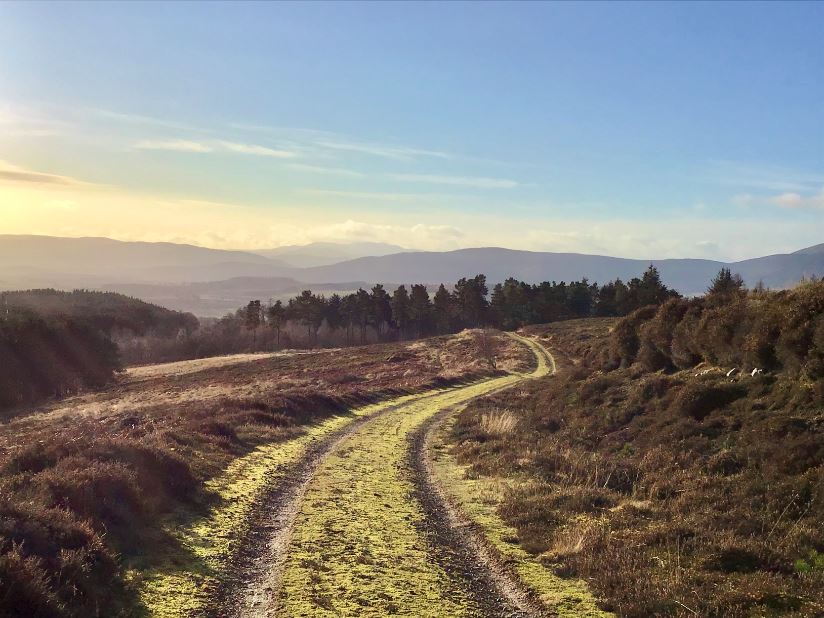
 We often enthuse about the wonderful views we enjoy on our walking expeditions. However, undertaken on a clear day, this walk must rank as one of our very best routes for all-around scenic quality. There are very few points on the track where there are not extremely fine views of the Howe of Cromar, and towards Mount Keen, (“Dark”) Lochnagar, and the distant Cairngorms. Much closer, and ever-present, are constantly changing views of the imposing “whale’s back” mass of Morven Hill (“A’ Mhòr Bheinn”, in Gaelic), immortalised by Lord Byron: “…when I rov’d a young Highlander o’er the dark heath, And climb’d thy steep summit, oh Morven of snow …”. At the summit cairn of Pittenderich, extensive views open up to the north, east and south-east, with the Bennachie range being most prominent. Although the overall ascent (363 m) is not inconsiderable for a low hill-walk, the gradient is generally spread throughout the ascent in a pleasant environment characterised by mixed farmland and woodland, making the walk far easier an experience than anticipated. At an early stage in the route, the walk passes the former country mansion of Douneside House, set in open parkland and gardens. Douneside now operates as an hotel and health club, within a wider estate managed by the MacRobert Trust which follows the wishes of the late Lady MacRobert for the House to remain a place of tranquillity and peace [see the notes at Waypoint 3 for a brief account of the MacRobert family tragedies around WW II]. The focal point of the walk is the summit cairn on Pittenderich at 508 m, a southern spur of Pressendye. The cairn is assumed to be a pre-historic burial location, perhaps used by different communities, at different times, over the millennia, but, as far as we can ascertain, no excavation has ever taken place at the site to shed more light. The walk starts and ends at the village of Tarland, which has a fine old Square with some buildings dating back around 300 years.
Links:
Photos from walk
Download Route Guide (PDF with illustrated Waypoints)
Download GPX file (GPS Exchange Format)
Access Walk on OutdoorActive
Access Walk on OSMaps
Access Walk on AllTrails
Access Walk on Wikiloc
