
Route Summary
 This is an easy walk with a very manageable ascent to impressive crags above the picturesque man-made loch. In good weather, and on a clear day, wonderful views throughout the walk are guaranteed.
Duration: 1.5 hours.
Route Overview
Duration: 1.5 hours.
 Transport/Parking: No local public transport to this location. Park in the lay-by at the walk start/end point. If needs be, there are other lay-bys on the access road, but take care not to block a passing place.
Length: 5.380 km / 3.36 mi
Height Gain: 136 meter.
Height Loss: 136 meter.
Max Height: 246 meter.
Min Height: 167 meter.
Surface: Moderate. Good paths, may be muddy in places.
Difficulty: Easy.
Child Friendly: Yes, if children are used to walks of this distance and overall ascent.
Dog Friendly: Yes, but keep dogs on lead on public roads and near farm animals.
Refreshments: Numerous options in Stirling.
Description
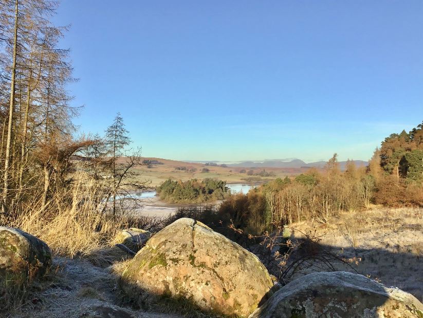
 This is a short but exhilarating walk around the North Third Reservoir, in farming countryside to the west of Stirling. Although man-made, the reservoir has attractive wooded islands, and occupies a beautiful setting, set off by the impressive crags on the west face of pine-clad Lewis Hill, an outlier of the Touch Hills. The short ascent to the crags is soon rewarded by some stunning views opening up to the picturesque reservoir, the surrounding farmland, and further afield, in the north-west aspect, to stand-out mountains such as Ben Ledi, Stuc a’Chroin and Ben Vorlich. The now disused North Third Reservoir is described as follows on the Scottish Places gazetteer: “It impounds the Bannock Burn by way of an earth embankment dam, and extends to an area of 54.4 ha (134 acres). Built in 1911 by Grangemouth Town Council to supply drinking water to that town, the height of the dam was raised in 1934 and again in 1936, to give a capacity of 3364 million litres (740 million gallons). By 1951 it was providing 9 million litres (2 million gallons) per day. It is now operated by Scottish Water. A filter system was constructed in 1931, including a now B-listed pump house. At the same time, a Bronze Age battle-axe was discovered, which is now housed in the Royal Museum in Edinburgh. This pump house became disused in 2000 and was sold in 2006. Water was subsequently diverted to Touch Water Treatment Works …”. The recreational trout fishery on the Reservoir is also now closed. All in all, this is an attractive walk with fine views from the crags and the banks of the reservoir.
See: https://www.scottish-places.info/features/featurefirst15648.html
Links:
Photos from walk
Download Route Guide (PDF with illustrated Waypoints)
Download GPX file (GPS Exchange Format)
Access Walk on OutdoorActive
Access Walk on OSMaps
Access Walk on AllTrails
Access Walk on Wikiloc
